Dominando o SIG para o Sucesso em Consultoria Ambiental
- Miguel Conceição
- 1 de fev.
- 5 min de leitura

Atualizado: 20 de mar.
No mundo atual, a interseção entre tecnologia e ciências ambientais nunca foi tão crucial. Os Sistemas de Informação Geográfica (SIG) emergiram como uma ferramenta poderosa para consultores ambientais, permitindo-lhes analisar dados espaciais, visualizar impactos ambientais e tomar decisões embasadas. Este artigo explorará como o domínio de SIG pode levar ao sucesso na consultoria ambiental, fornecendo dicas práticas e exemplos para ajudá-lo a utilizar essa tecnologia de forma eficaz.
Entendendo o SIG e sua importância na consultoria ambiental
O SIG (Sistema de Informação Geográfica) é uma estrutura para coletar, gerenciar e analisar dados com base no contexto geográfico. Ele permite que consultores ambientais visualizem conjuntos de dados complexos, identifiquem padrões e tomem decisões orientadas por dados. A importância do SIG na consultoria ambiental é inegável:
Visualização de Dados: O SIG transforma dados brutos em mapas visuais, facilitando a compreensão e a comunicação das descobertas.
Análise Espacial: Permite que os consultores analisem relações e tendências espaciais, o que é crucial para a avaliação de impactos ambientais.
Apoio à Decisão: O SIG fornece uma plataforma robusta para a tomada de decisões, auxiliando os consultores na recomendação de práticas e soluções sustentáveis.
Principais aplicações de SIG na consultoria ambiental
O SIG (Sistema de Informação Geográfica) possui uma ampla gama de aplicações em consultoria ambiental, incluindo:
Avaliações de Impacto Ambiental (AIA): O SIG é essencial para a realização de AIAs, permitindo que consultores mapeiem os impactos potenciais em ecossistemas, recursos hídricos e comunidades.
Seleção de Locais: Ao selecionar locais para desenvolvimento ou conservação, o SIG ajuda a identificar locais adequados com base em critérios ambientais.
Gestão de Recursos Naturais: O SIG auxilia na gestão de recursos naturais por meio da análise do uso da terra, cobertura vegetal e habitats da vida selvagem.
Rastreamento da Poluição: O SIG pode rastrear fontes de poluição e seus impactos na qualidade do ar e da água, ajudando consultores a desenvolver estratégias de mitigação.
Análise de Mudanças Climáticas: O SIG é usado para modelar cenários de mudanças climáticas, avaliar vulnerabilidades e planejar estratégias de adaptação.
Introdução ao SIG
Para quem é iniciante em SIG , a curva de aprendizado pode parecer íngreme. No entanto, com a abordagem correta, qualquer pessoa pode se tornar proficiente no uso de SIG para consultoria ambiental. Aqui estão alguns passos para começar:
Escolha o software SIG certo
Existem diversas opções de software SIG disponíveis, cada uma com seus pontos fortes. Algumas opções populares incluem:
ArcGIS: Uma plataforma SIG abrangente, amplamente utilizada na indústria, que oferece ferramentas avançadas para análise e mapeamento.
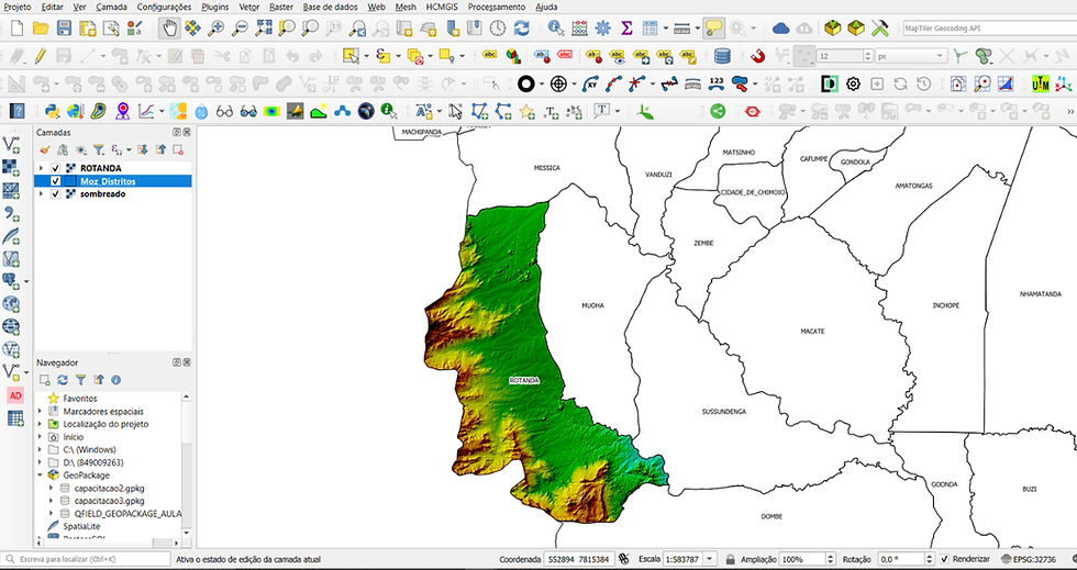
QGIS: Uma alternativa de código aberto que oferece muitos recursos encontrados em softwares comerciais, tornando-a acessível para iniciantes.
Google Earth Pro: Uma ferramenta intuitiva para mapeamento e visualização básicos, adequada para avaliações rápidas.
Aprenda o Básico
Familiarize-se com os conceitos fundamentais de SIG, incluindo:
Camadas: Compreender como trabalhar com diferentes camadas de dados (por exemplo, topografia, uso do solo, hidrologia) é crucial para uma análise eficaz.
Sistemas de Coordenadas: Saber como navegar em diferentes sistemas de coordenadas ajudará você a posicionar seus dados com precisão.
Fontes de Dados: Aprenda sobre diversas fontes de dados, como imagens de satélite, bancos de dados governamentais e levantamentos de campo.
Aproveite os Recursos Online
Existem inúmeros recursos online que podem ajudá-lo a aprender SIG:
Webinários e tutoriais: Muitas organizações oferecem webinários e tutoriais gratuitos que abrangem diversos tópicos de SIG.
Cursos online: Plataformas como Coursera e Udemy oferecem cursos estruturados sobre SIG, frequentemente voltados para aplicações ambientais.
Comunidades de SIG: Participar de fóruns e comunidades online pode fornecer suporte, recursos e oportunidades de networking.
Exemplo Prático de SIG em Acção
Para ilustrar o poder do SIG na consultoria ambiental, vamos explorar alguns exemplos do mundo real.
Estudo de Caso 1: Planeamento de Conservação de Habitat
Uma decterminada empresa de consultoria ambiental utilizou SIG para desenvolver um plano de conservação de habitat para uma espécie ameaçada. Ao mapear os habitats existentes, o uso da terra e as ameaças potenciais, a equipe identificou áreas críticas para a conservação. A análise com o SIG revelou que certas regiões eram mais vulneráveis às pressões do desenvolvimento, permitindo que a empresa priorizasse os esforços de conservação de forma eficaz.
Estudo de Caso 2: Monitoramento da Qualidade da Água
Uma outra empresa de consultoria utilizou SIG para monitorar a qualidade da água em um sistema fluvial. Ao integrar dados de diversas fontes, incluindo amostragem de água e padrões de uso do solo, eles criaram um mapa abrangente das fontes de poluição. Essa representação visual ajudou as partes interessadas a compreender a relação entre o uso do solo e a qualidade da água, possibilitando intervenções direcionadas para reduzir a poluição.
Estudo de Caso 3: Plano de Resiliência Climática
Uma cidade contratou uma consultoria ambiental para avaliar sua vulnerabilidade às mudanças climáticas. Utilizando SIG, a consultoria modelou possíveis cenários de inundação com base na projeção de elevação do nível do mar. A análise destacou áreas de risco, permitindo que a cidade priorizasse melhorias na infraestrutura e desenvolvesse um plano de resiliência climática.
Melhores práticas para o uso de SIG em consultoria ambiental
Para maximizar a eficácia do SIG em seu trabalho de consultoria, considere as seguintes boas práticas:
Mantenha a qualidade dos dados
Certifique-se de que os dados que você utiliza sejam precisos, atualizados e relevantes. Valide regularmente suas fontes de dados e considere as limitações dos dados com os quais você está trabalhando.
Colaborar com as partes interessadas
Interaja com as partes interessadas ao longo de todo o processo de trabalho. As suas opiniões podem fornecer um contexto valioso e ajudar a garantir que a sua análise responda às suas preocupações.
Comunique as Conclusões de forma Clara
Ao apresentar resultados de SIG, priorize a clareza. Utilize visualizações fáceis de entender e evite sobrecarregar o público com jargões técnicos.
Mantenha-se Actualizado com a Tecnologia
A tecnologia SIG está em constante evolução. Mantenha-se informado sobre novas ferramentas, técnicas e tendências na área para aprimorar suas habilidades e melhorar seus serviços de consultoria.
Desafios de SIG para Consultoria Ambiental
Embora o SIG ofereça inúmeros benefícios, também apresenta desafios que os consultores ambientais devem enfrentar:
Limitação de Dados
O acesso a dados de alta qualidade pode ser uma barreira. Em algumas regiões, os dados podem estar desatualizados ou indisponíveis, limitando a eficácia das análises de SIG.
Habilidades Técnicas
A proficiência em SIG exige um certo nível de habilidade técnica. Os consultores devem investir tempo em treinamento e prática para se tornarem proficientes no uso de ferramentas de SIG.
Integração com Outras Ferramenmtas
A integração de SIG com outros softwares e ferramentas pode ser complexa. Os consultores devem estar preparados para solucionar problemas de compatibilidade e aprender a combinar diferentes tecnologias de forma eficaz.
Tendências futuras em SIG para consultoria ambiental
Com o avanço contínuo da tecnologia, diversas tendências estão moldando o futuro do SIG (Sistema de Informação Geográfica) na consultoria ambiental:
O Uso Crescente do Sensoriamento Remoto
A tecnologia de sensoriamento remoto, incluindo drones e satélites, está se tornando mais acessível. Isso permite que os consultores coletem dados de alta resolução para análise, melhorando a precisão de suas avaliações.
Integração de IA e Machine Learning
A inteligência artificial e o aprendizado de máquina estão sendo integrados aos SIG, possibilitando análises mais sofisticadas e modelagem preditiva. Isso pode aprimorar os processos de tomada de decisão em consultoria ambiental.
Análise de Dados em Tempo Real
A capacidade de analisar dados em tempo real está se tornando cada vez mais importante. Ferramentas de SIG que podem processar e visualizar informações em tempo real fornecerão aos consultores insights oportunos para uma tomada de decisão eficaz.
Conclusão
Dominar o SIG é essencial para o sucesso na consultoria ambiental. Ao compreender suas aplicações, aprender as habilidades necessárias e manter-se atualizado com as tendências, os consultores podem utilizar o SIG para tomar decisões informadas que beneficiem tanto o meio ambiente quanto seus clientes. Ao iniciar sua jornada no SIG, lembre-se de que a chave para o sucesso reside na aprendizagem e adaptação contínuas. Abrace o poder do SIG e você estará bem preparado para enfrentar os desafios ambientais de hoje e de amanhã.

Comentários